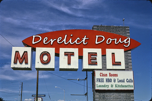
When people around the globe think of the American highway system, images of motels along Route 66 is often what comes to mind. These motels were typically family-owned and operated. Bringing with them a certain kind of kitsch and charm that made its way deep into the American culture. Increasingly these icons are being abandoned, repurposed, or being demolished. With that in mind, I would like to take a moment to reflect on how these icons of American innovation came to be and eventually fell from favor.
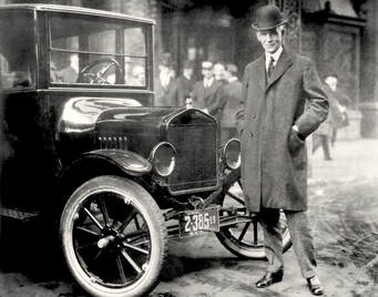
Like all innovation, Motels were created out of necessity. One that began on October 1, 1908, when Henry Ford unleashed his Model-T on the American market. Thanks to his innovation of the assembly line; he was able to offer the Model-T for the shockingly low price of $360. For the first time, the American working class could afford a vehicle and they were hungry to explore their vast country. And this group was growing daily, by 1914 Ford had sold half a million cars. With the advent of Ford’s “Tin Lizzie” car the pace of sales increased. So much so that by 1927 they comprised half of the cars on the road. By this time Mr. Ford had sold over 15 million automobiles.
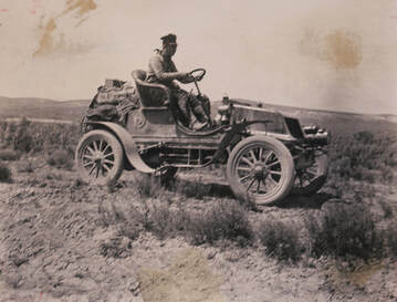
Now that the automobile was ubiquitous the American people's desire to explore was at an all-time high. However, travelers and adventure seekers were growing restless with the local roadways. Many of these roadways were not yet paved and seldom connected from city-to-city. The roads that did connect were long-established trails that were converted for automobile use. Travelers east of the Mississippi River were fortunate to have colonial-era Inns to stay in while traveling between towns. However, these Inns were few-and-far-between. In the western half of the country, the drivers relied on camping and makeshift shelters to rest in between drives. As the number of people on the road increased the cost of the Inns increased too. So much so that they eventually became too expensive for the average American consumer. To help alleviate this problem the U.S. Department of transportation set up camps across the country. The camps were simple and comprised of army surplus tents.
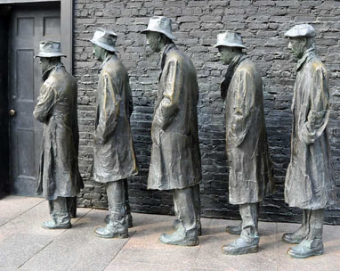
The road improvements that the U.S. citizens wanted would have to wait. After some of the largest economic growth in history, the U.S. stock market suddenly crashed; in 1929. Ushering in the “great depression”. This period in U.S. History was fraught with economic hardship, desperation, and hunger.
Fortunately, by 1933 America was roaring back from the great depression. But many people were still out of work and the roadways had seen little improvement. The Americans' desire to explore had not gone away, it was merely put on hold until the economy was stable. The Work Progress Administration (WPA) and similar organizations were able to put many people back to work by building the roadways and the electrical infrastructure that millions of Americans crave. 
In 1939, a man named John Steinbeck envisioned a road that crosses the country from Chicago to Los Angeles. He called his design “the road of flight”. Later his vision would become the internationally known “U.S. Highway 66” or “Route-66”. The original name was designed to evoke the realities of the great depression-era immigrants and migrants. These were people who were removed from their land by failing crops, heartless banks, and the storms from “the great dust bowl”. In many cases, the land that was taken from them was land that they (or their family) settled and homesteaded.
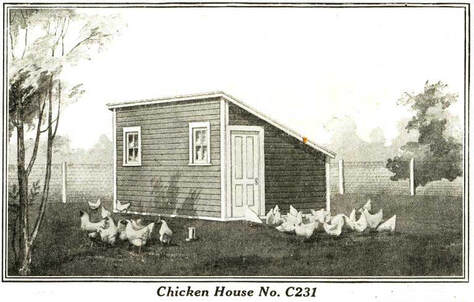
This group struggled to find a sense of home as they drifted along the roads. At this time some of the earliest motel concepts were developing in the Western U.S. These were small, simple structures with a door, a bed, and a window. One of the most commonly used designs was “Sears Roebuck chicken-coops” that were repurposed as motel-like cabin structures. The privately-owned cabins were sometimes painted to match a design theme; such as western homestead or bavarian village. This was one of the earliest attempts to bring a sense of home and familiarity along for the road trip. However; the cabins themselves sported little amenities. Often a bucket of water and wood was included with your cabin, but sheets, pillows, and mattresses were only available with an extra fee.
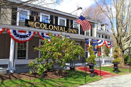
Back in the Eastern U.S., the Colonial-Era Inns were completely full, but an alternative had developed. People began to open up their homes to tourists. These homes would simply place a “Room for Tourists” sign and instantly open a new income stream for their home. Each “tourist-home” was as colorful and unique as its owner. In contrast to today’s hotels, these were commonly found in-town and required searching out to be found. This option gave travelers all of the comforts of home or at least all of the comforts afforded to them by the homeowner.

This practice was so common that a side-industry of printing the signs developed. Buried in attics and deep in antique shops you may still find some of the original cardboard “Rooms for Tourists” signs. While the homes helped to bridge the gap, there were more Americans on the road than there were rooms to rent.
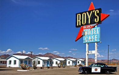
In the 1930s and 1940s the Eastern U.S. concept of Mom and Pop tourist-homes was combined with the cabin concept, developed in the Western U.S. These hybrid properties resembled what we’ve come to know as a motel. At the time they were referred to as “cottage-courts” or “tourist-courts”. Unlike tourist homes or downtown hotels, these were automobile friendly. Many sported carports and filling stations. The cottage court was becoming a classy alternative to damp cabins and smoky campsites. They were designed to catch the eye of the passing and weary travelers. This is where the tradition of silly and gaudy themed Motels came into existence.
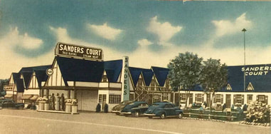
Later cafes and restaurants began to appear alongside cottage-courts. These cafes were the innovation hub for American cuisine, bringing to us some of the staples that we cook to this day. In fact, it was at “The Sander Court & Cafe”, where Harland Sanders, created the first batch of fried chicken. As you may be aware, Harland later took the name the “Kentucky Colonel” and founded the KFC company. To me, it’s somewhat ironic that he left the lodging industry to help create the fast-food industry. Both of these were satellite industries made possible as a result of Henry Fords’ invention and the new roadways.
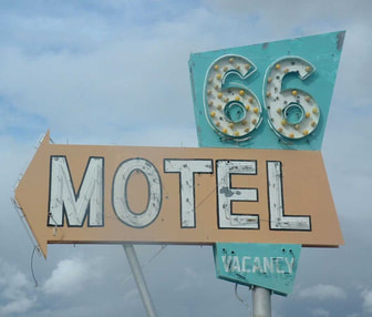
The U.S. Motel industry had its second big recession during World War II. This is because nearly everything needed for a road trip was rationed. All tires, gasoline, and oil went to the war effort. Many of these materials were used to transport troops across the country to be deployed. During this process, soldiers saw areas of the country they wanted to revisit once they had leisure time.
U.S. President, Dwight D. Eisenhower became frustrated with how long it took to transport troops and tanks across the country. He pushed for a Highway system that mimicked the German autobahn. His push succeeded and gave birth to the “Federal Interstate Highway System” (FIHS). This new organization was tasked with constructing four-lane highways that stretched from coast-to-coast. However; this would take half a century to complete and they are still being built on to today. 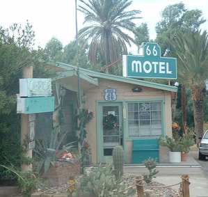
Fortunately for the cottage-court owners, they had many years before the interstate highway system would snake through the country and circumvent the highways they relied on; such as Route 66. This time period was the golden age of the American Motel. Post-war American families were ready to explore the country once again!
At this time the name cottage court gave way to “motor-court”. Further verifying and cementing Americas' love of and reliance on the automobile. At this time, motor courts specifically catered to automobile owners and were no longer individual cabins, rather they were multiple rooms under one roof. Each one brought its own breed of neon lights, bright signs, and eye-catching flair. The buildings themselves were plain and functional concrete block structures. However, they sported elaborate facades that reflected the flavor and style of the region that the hotel was in. Periodically the sparkly facades and signs would invoke regional stereotypes and cultural appropriation. But this was done at a time before we had these considerations. 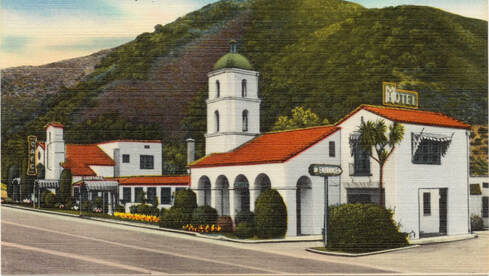
The name “Motel” was coined in San Luis Obispo, CA at the “Milestone Mo-Tel”. The name stuck to this day and is used to refer to a roadside hotel designed primarily for motorists, arranged in a low building, with parking outside.
As most know, the good times came to an end for the majority of these Motels. By the early 1960s, the F.H.I.S. and the interstate highway system were very advanced and had circumvented most of the state highway systems. Family-owned motels and motor courts were being replaced by large chains; such as Howard Johnsons and Holiday Inn. These Hotel chains were able to build and grow alongside the Interstates. The consistency and cleanliness that these chains offered were unparalleled. And for the first time, travelers could cross the country knowing exactly what to expect from their Hotel chains. 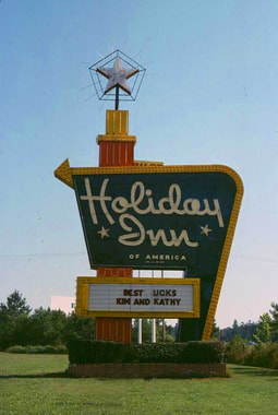
Holiday Inn blurred the distinction between motels and hotels in a manner that was exciting. Their signs were taller, brighter, and very different from the other flickering neon motel signs. The Holiday Inn sign was designed to be seen from the new interstates. As Holiday Inns popped up everywhere, the signs became understood to mean: “Turn here for a predictable, quality experience”.
This consistency and sameness came at a cost. The unique look and feel of the Mom and Pops Motels had a charm and aesthetic that is mimicked and appreciated in pop culture to this day. Much of the signage that you see in modern-day New York or Las Vegas harkens back to the motels of yesterday. It’s amazing to me, what the invention of the automobile has done. Even more fascinating; it was the innovation of a simple cardboard sign stating “Rooms for Travelers”, that sparked countless more inventions, roadside attractions, foods, and most importantly memories. 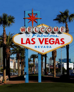
Today most Americans prefer the ease and reliability of the interstate highway system and the numerous Chain Hotels that sit directly off the road. You can still find open and thriving roadside attractions and Motels on state highways. Most often you will find them at the intersection of state highways and interstates. I encourage you to give a Motel a try the next time you find yourself in a position to stay in one. Even if it’s for one night, it's worth it to experience a classic Motel. Especially if you haven't yet had the chance to.
If you have stayed in a vintage motel in the past, please comment below with your experiences and thoughts: American Motel Photos:Music from the video:
1 Comment
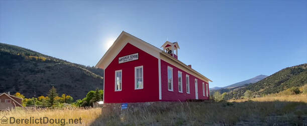
lorado has many one-room and small schoolhouses. While these are no longer used the structures provide a fascinating glimpse into the past. Giving us insights into the lives of the American Pioneers. Many of the ranching and mining communities I cover had schools that no longer exist or were turned into private residences. Little records exist besides the oral traditions and the fact that these buildings were once the hub of many children's lives.
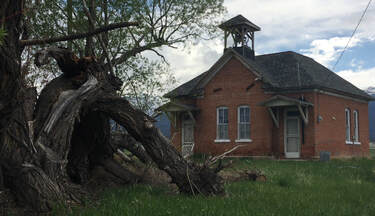
Today I would like to focus on two such examples; however, there are countless other schoolhouses that dot the landscape. But before I dive into the specific locations, I would like to give a little more context into the region of Colorado that they rest in. The area in modern times is Called “Chaffee County”; however, Chaffee was only created when Lake County was divided into multiple jurisdictions. The original Lake county was designated in the area long before Colorado received its statehood. The Lake County Territory stretched from the headwaters of the Arkansas River to the Utah state line. This is significant because many of the schoolhouses were built in the 1860s, this would be about 16 years before Colorado was a state. Just 12 years before this land was a part of Mexico and at the time the schools were built it was primarily inhabited by Native Americans. These are some of the earliest structures built by Westerners and illustrates that pioneers had an emphasis on education.
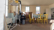
These schools often were tiny and uncomfortable log cabins or one-room schoolhouses. They were heated by wood or coal stoves. They had little insulation and tended to be drafty in winter. Most of the original wooden schools burnt and were replaced by brick or stone buildings
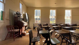
The teacher was often only one year removed from school. Literally having been a part of the class just one year before. The maintenance of the building all rested on the Teacher. They served as the principal, janitor, lunch lady, and everything in between. The “three R’s”, readin’, ritin’, and rithmetic were the primary focus of the lessons. They had daily oral recitations done in stages (or grades). Spelling bees, math matches, and other games were later introduced to make learning more fun. Many of the students did not go further than 4th grade. However; many pupils desired to learn enough to self teach and become successful members of society.
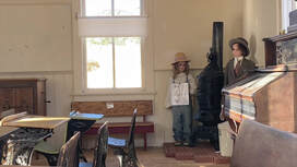
Gas Creek School
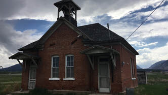
This charming little red brick schoolhouse was built in 1890 and officially formed the “Gas Creek School District”. It was built on land that was donated by the Fehling family on condition that if it was not used as a school within two years, ownership would revert back to the family. However, it operated as the sole school in the district for 49 years. The double entranceway was added in 1909 and was used to segregate boys and girls. The two out-houses in the back of the school were installed by the Work Progress Administration (WPA) project in 1930. The school held classes in the building up until 1942. 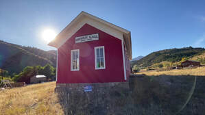
The interior has been modified into a residence. The exterior of the building has changed little and is an iconic example of early 20th-century rural schools. The schoolhouse eventually made its way back to the Fehling family by 1958 and was sold a few more times. During this period it fell into disrepair. Fortunately, In 2019 it was added to the National Register of Historic Places. This was made possible by a grant from the Colorado State Historical Fund. While we have not seen any restoration, I am anxiously waiting to see what this historical gem looks like after a little polishing!
Maysville School
About 40 miles south of the Gas Creek District is the site of the former Maysville School district. Maysville began with the name of “Crazy Camp.” Why it was named that is not known, but it was changed to Maryville. It was named after a local pioneer “Mary”. However; over the years it was shortened to “Maysville”. And kept this version of the name to this day. Personally, I kind of prefer “Crazy Camp”, but I can see why they may have wanted to change it. Maysville went on to become one of the richest districts in the area. 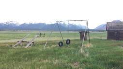
Maysville School began in 1870, six years before Colorado became a part of the United States. The bell that beckoned students was originally hung in the Union Sunday School and Congregational Church building. At some point, those buildings were moved to Salida. At that time the bell was hung in the school tower, where it sits to this day.
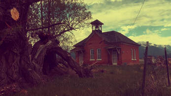
Maysville was known for offering its teachers slightly better salaries. That said they were given about $6.25 monthly. When you consider that the average laborer was paid $8-9 a month, this was still a low salary. The Maysville teachers had the added benefit of on-site living quarters. Because of this, water was piped into the school building. Which made it one of the few country schools without a well, water bucket, and dipper. However; these amenities were not enough to keep most teachers for more than a year. In-fact only two teachers returned to teach for a second year.
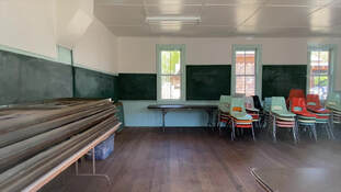
The Maysville school held classes until 1958 when most of the regional schools were closed and consolidated into two large school districts (Salida and Buena Vista). At that time the Maysville school became a bus barn to house the bus used to take students to school in Salida. In 1977 the school was donated to the Sakida Historical Society (SHS). At the time there was some controversy. Some felt the school district should not be giving away this property without having an idea of what it is worth. Glen Everett from the SHS was quoted as saying that he felt “the building was worth more for its historical value than what the district could get for it on sale”. It has since been beautifully restored to its original state. It is now used as a museum for the area.
Learn when you can, visit the Salida Museum Here: http://bit.ly/SalidaMuseum 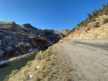
As you make your way East on Highway 40 and the town of Kremmling Colorado fades into your rearview mirror, you’ll pass the area known as “Old Park Colorado”. Taking a right onto CO-134 you will begin your ascent through the Gore Pass and make your way deep into Old Park Colorado.
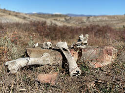
This land was originally used by the Ute Indians, who camped in the valley for more than 1,000 years prior to the arrival of the first white settlers. During the warm months, they migrated from Utah to hunt the Bison in the Gore Pass. Early settlers; fur trappers, observed the Ute bathing in the local springs. But soon after this, they disappeared from the area with no written trace. However; clues to their existence remain evident and are of interest to archaeologists to this day.
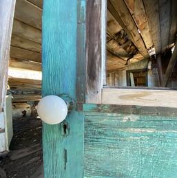
In the late 1800’s the western expansion brought wagons loaded with furnishings, household goods, and entire families. The first group of settlers came to the valley to the ranch the rich and fertile grasslands.
Today I would like to look at one such settlement that is now falling into ruin, the Burke Springs Creek Ranch. The homestead and settlement consist of 9 standing structures, fencing, a chicken coop, and numerous empty or burnt plots. According to locals it was once used as a dairy farm; however, like many of the ranches in the area it became too costly to keep dairy cows and they switched to raising beef cattle. 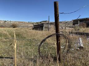
In 1983 the Burke Springs Creek Ranch was purchased by a young and enthusiastic conservationist who recently moved to Colorado. Over the next 34 years, He and his wife were able to make many improvements to this property and many other properties in the district. However; these improvements mainly revolved around irrigation and water supply. He was quoted as saying “We really have a sustainable form of agriculture in this area with simple irrigation to grow enough hay for the winter to keep the cows fed and enough range to sustain them during the summer.”
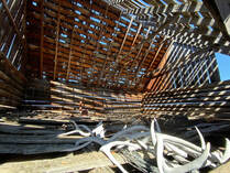
This Burke Springs Creek Ranch continued to be privately owned, until in 2006; when 70-acres were donated (under easement) to the Colorado Headwaters Land Trust (CHLT). The land trust performs annual water monitoring and basic land management. The CHLT describes the owners as life long conservationists, who still graze cattle on the land to this day. Which is fitting, when you consider the land has been agricultural land since it was settled and homesteaded in 1897.
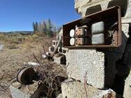
The name of the area was recently dubbed “Old Park”. The name comes from when the region was broken up into multiple properties and filings. Basically, it’s a massive sub-development. It houses 371 lots in total and they average around 5 acres apiece. It’s favored by people who enjoy snowmobiling, hiking, fishing, having few neighbors, and all things outdoors.
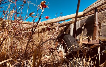
As you crest gore pass you will dip and dive through, beaver dams, rolling meadows, aspen groves, and eventually make your way to the Rock Creek Stage Stop. This is a must-see drive if you are a fan of the autumn foliage. The stage stop is a well maintained two-story log building. It was once used as a stagecoach route from Yampa to Kremling. Additionally, it was an Inn and served as a polling station. The building is maintained by the Routt County Historic Society. The Rock Creek Stage Stop is free to visit; however, donations are always encouraged.
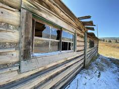
It’s great to see that the Rock Creek Stage Stop and some of the privately-owned cabins are standing the test of time. If you were to look around throughout the Gore Pass you will see many abandoned ranches and settlements that do not have the same fate. They dot the landscape, tucked between modular homes, and cattle ranches. It’s likely too late for the Burke Springs Creek Ranch to be saved, but I am glad we are able to see it before it completely goes back to nature.
I would like to thank the Volt family, Colorado Headwaters Land Trust, and the Routt County Historic Society for the preservation and conservation efforts that they have undertaken in the community. With that in mind, I would like to kindly encourage you to, please support your local historical society. Photos from the Day:Music from the Video: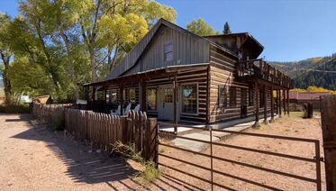
Ohio City is a “semi-ghost town”, in the Quartz Creek Valley; just a few miles away from the more populated town of Pitkin Colorado. Many of the original homes remain, but the main street has suffered the loss of most of its buildings. Like many Colorado ghost towns, Ohio City; has had a few declines and rebirths. The most recent of which happened in the 2010s. In fact, I would say this town has the potential to come back, but I’ll cover that a little later.
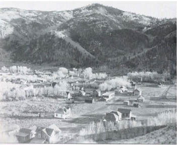
Ohio City got its start in the 1860s when gold was discovered in the region. Interestingly, the location and source of the gold nuggets discovered remain unknown. However, the elusive source of gold ran dry in just under a decade. At that time the town was left completely abandoned.
Ohio City saw it's second coming in 1879 when an assayer named Jacob Hess found silver in the Gold Creek. Jacob promptly renamed the creek “Silver Creek”, and with that action, he kicked off a population boom in Ohio City. Jacob was considered the first settler in the area despite the previous settlement. He took the opportunity to rename the settlement “Eagle City”; however, once the settlement grew into a town, it once again took the name “Ohio City”. The very next year the Denver, South Park and Pacific Railroad was built through the town. In the process, they created the now-famous alpine tunnel. 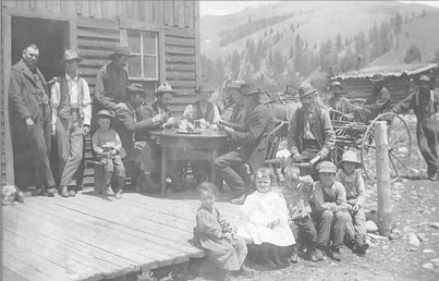
In 1893 the price of silver collapsed overnight and the town quickly followed suit. The population of Ohio City dwindled until 1895 when the town was once more declared deserted.
Fortunately, in 1896 a new source of Gold had been discovered. This once again made Ohio City a lucrative investment and the town's population rushed back in. One of the largest investments was the Willow Creek Mine, which still operates to this day. Although at a different capacity as it now mines for common gems, quartz, feldspar, graphic granite and the smallest imaginable flakes of gold. This illustrates to me just how few people are needed to operate a modern mine. This is most evident when you consider that the mine is still open, but Ohio City is nearly deserted. 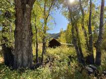
That said; in 1896 three Harvard University students and brothers returned to survey the land once more. The carter brothers as they were known soon formed the Carter Mining Company. At about the same time a man named E.M. Lamont began the Raymond Consolidated Mines Company. These two organizations began to mine in Ohio City in 1908 and continued work until 1912 when the profit dried up. This began the 3rd decline of Ohio City.
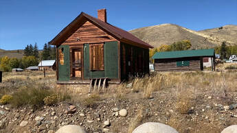
In 1936 the entire region had a boost when the Works Progress Administration (WPA) issued a construction grant for $20,000 to build the Monarch Ski resort. Projects like this were common during the Great Depression and were a good way to put people back to work. Furthermore, the resort helped to stabilize the community for years to come.
In 2012 Gunnison County applied for and received grant funds from the Colorado State Historical Fund. The funds were primarily used to rehabilitate the Ohio City’s City Hall, Jail, and School House.
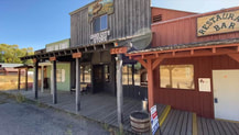
Once all of their improvements were complete the building was equipped with, the general store, two apartments, a liquor store, a gift shop, a Restaurant, and Bar. Not to mention they added 10 RV hook-ups, a septic system, and outbuildings. This was and still is the single most equipped building within the next three towns.
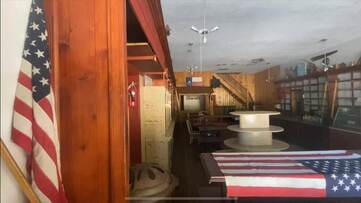
This wasn’t John and Pat’s first go at owning a western restaurant. In-fact before the opened up shop in Ohio City they owned the largest restaurant in Cheyenne WY, the Mayflower. John was able to leverage his contacts in Louisiana and Wyoming to develop a shipping method that delivered fresh fish to the Mother Lode every two weeks. To offer fresh seafood in the Rockies was a rare treat. Customers were quoted as saying “What an amazing and unexpected experience in the middle of the backcountry“, and raved about the fresh flounder and Jambalaya. For a time the Mother Lode was the heart of the community and is what kept Ohio City from being considered a complete ghost town. Unfortunately, in 2016 the Mother Lode closed its doors and ushered in Ohio City’s first ghost town era in over 114 years.
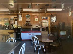
On a personal note, I believe this town can come back. At least the Mother Lode could be brought back at a reduced capacity. The property is still up for sale and is in amazing condition. It had very healthy street traffic when I visited (and I visited off-season). It’s literally move-in ready and is available for just under a million dollars. While this is a steep price, it comes with a boatload of potential. Today you can find souvenir keychains from the Mother Lode being auctioned off on eBay and are sold as collector's items on Amazon. People from the area still speak fondly of the Mother Lode and would welcome its return. Perhaps with a new set of products, new management, and a slightly less complicated LLC structure this business could once again succeed. And in the process lift this town out of ghost town status.
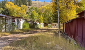
Today, no active businesses remain, but there's a lovely walking tour available. The town is occupied by a few seasonal residents and visiting 4x4 enthusiasts. Much of Ohio City is either for sale, boarded up, or downright abandoned. You can find Ohio City on CR-76. If you are heading from Gunnison: Take US-50 East for 11 miles, turn left on CR-76, Follow for 8.8. From Salida: take US-50 West to CR-76 and continue for 11 miles.
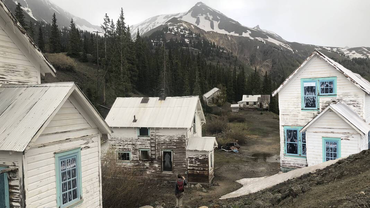
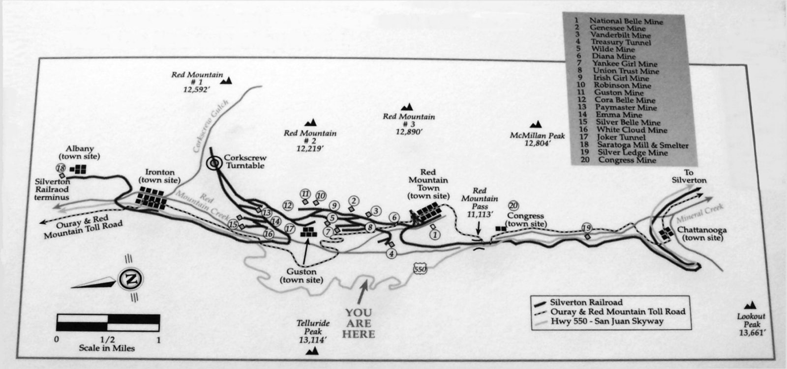
Idarado & Red Mountain Town are a bit of an enigma and is a hard townsite to identify. The final resting place of Red Mountain Town is equal distance between Oury and Silverton Colorado off of U.S. Highway 550. However; the town was moved once and burnt twice. Meaning you can find a few versions of Red Mountain Town. The Denver Times described the town by saying “Red Mountain was the mecca for all who were allured into the San Juan by the fickle goddess of fortune.”
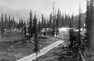
The original town was settled in 1879 when a group of silver deposits were found nearby. At that time it was a small mining camp and went by the name of Sky City. The camp was below the National Belle Mine; however, it would later be relocated. This is because the residents of Sky City first built their camp in wintertime when the ground was frozen solid. Once spring came around the townsite became swampy, fly-infested, and messy.
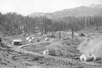
At the same time, several other settlements and tent cities were also being established in the Red Mountain Pass, including Barilla and Rogersville. Which were also situated below the National Belle Mine.
A surveyor from Silverton Colorado made his way to Rogersville and plotted out the first town plat. It was comprised of four streets and one business. Around this time the people from Sky City decided it was time to get out of the swamp. They packed up and relocated directly next to the Rogersville townsite. This was only a move of a few hundred yards, but it made all the difference for the miners of Red Mountain Town. They were closer to Otto Mears’ toll road (the million-dollar highway) and the National Belle Mine. Not to mention away from the increasingly swampy conditions of the then defunct Sky City. 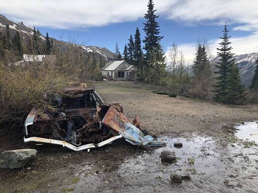
They had established a town company and petitioned for a post office. The post office was established in January 1883; despite the fact that it was primarily made of tents and had few permanent wooden structures. When the post office was established, it was the first settlement to dawn the name “Red Mountain Town”. In short order, the town had two newspapers, numerous homes, a hotel (The Hudson House), and a multiple story Saloon called the “Assembly Club”. By this time the town of Red Mountain had incorporated the surrounding communities of, Sky City, Sweetville, and Rogersville.
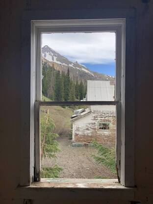
Meanwhile back in Barilla; a competitive townsite had quietly been building up a little further north and today rests on the north side of the Million Dollar Highway (U.S. Highway 550). This town was less than a mile away and decided to take the name “Red Mountain City”. This was controversial and was intentionally designed to irritate the residents of “Red Mountain Town”. Keep in mind that all of the communities in the Red Mountain Mining District were competitive, but the proximity and similar names made the rivalry even more bitter between these two camps.
Almost immediately there was confusion between the two settlements. Shipments of supplies would be incorrectly delivered and seldom were returned. Several disputes were recorded concerning misunderstood deeds and bank transactions. To exacerbate the confusion, both newspapers referred to their town as “Red Mountain”. Acting as though “Town” or “City” were never a part of either town's name. The editors of each newspaper would exchange weekly barbs through open letters, editorials, and occasionally direct accusations. 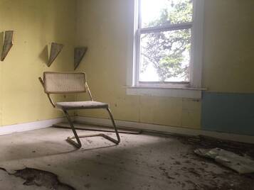
The entire Red Mountain Mining district was talking about this rivalry. The naming dispute was finally put to an end when Red Mountain City petitioned for a post office. The U.S. Postal Service chooses to call the town “Congress”. Because the town was closest to the “Congress Mine”. The newly coined town of Congress was the loser in more ways than one. This is due to the fact that most of the silver deposits were on the south side of the Million Dollar Highway. By 1887; just 8 years after the feud began, only a few residents remained in Congress and Red Mountain City was a thing of the past.
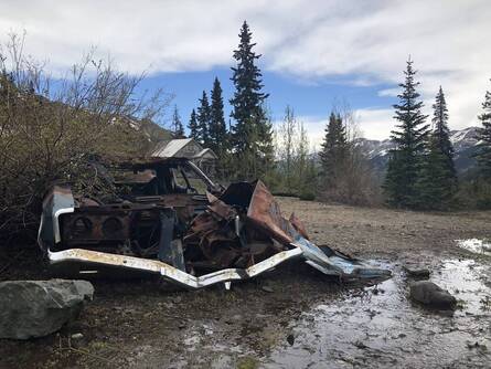
It seemed as though the miners of Red Mountain Town and the National Belle Mine had a limitless supply of luck. Especially, when in 1887 they found a massive cavern filled with gold and silver. The lucrative find was reported across the United States. Overnight international investors began to pour money into the town and mine. By 1888 the Silverton Railroad was connected to Red Mountain Town. They were happily boasting as having “an escape-proof jail”. Basically; they had come a long way from their humble ad swampy beginnings. 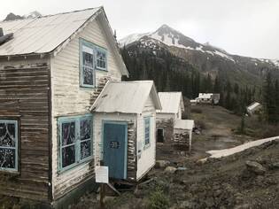
Despite all of the civic improvements it only had a population of 598, by 1890. The town had a reputation as one of the roughest towns in the Red Mountain District. However; at its peak it hit 1,000 citizens and had numerous saloons and a theater.
In the summer of 1892 a fire began in the kitchen of the Red Mountain Hotel. It quickly spread through the wood structures, in spite of the brave efforts of the volunteer firemen and residents. The fire destroyed the majority of the town. By the time it stopped burning all 15 buildings along Main Street were gone. In-fact only the depot and the jail survived. The gritty group of residents that remained soon rebuilt the town. The town suffered its second fire in 1899, at that time, only 12 citizens remained in the town. 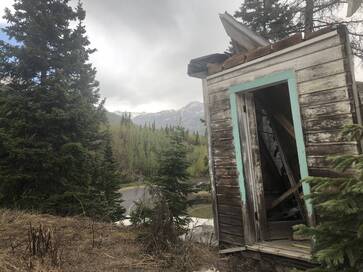
Red Mountain Town saw a brief resurgence in 1901. Along with most of the towns in the Red Mountain District. Many people predicted that the town and the mines would thrive again but they never did. At this time, several of the area mines were consolidated into the Idarado Mining Company (later to be acquired by The Newmont Gold Company). The National Belle, Guson, Terusry, Congress, and dozens of other mines were all consolidated. The new mining operation eventually created 100s of miles of tunnels. So extensive that they still connect below the city of Telluride and the remains of Red Mountain Town.
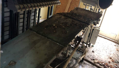
The town limped by until the Idarado mines and mill closed in 1978. At this point, Red Mountain Town was primarily used for seasonal and short-term housing for the miners. In 1983 the State of Colorado filed suit against the Idarado Mining Co. for natural resource damages and the subsequent lead poisoning. A few people remained in Red Mountain Town until 1986, when a study (financed by the Idarado Mining Co.) found 7% of the children tested in the area had above average lead levels, in 1993 the Centers for Disease Control concluded that the lead levels were 3% higher than previously thought and reported.
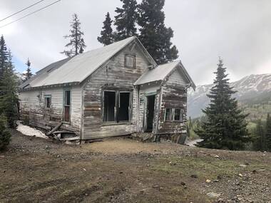
Today, the Newmont Mining Company (formerly the Newmont Gold Company) and the State of Colorado are working to remove lead, acids, zinc, and heavy metals from the region and its water supply. They are pioneering new methods of revegetation that will one day; hopefully, cover the tailing piles that litter the valley.
The remains of Red Mountain Town can be seen from the top of Red Mountain Pass, 13 miles South of Ouray. For a closer look, the Red Mountain District can be accessed with an ATV or high clearance vehicle on County Road 31; 12.8 miles south of Ouray. Map of the Area:Learn More About Idarado and Red Mountain Town:
“Their architecture and construction are not significant for their artistic value or skilled craftsmanship,” the report states. But, it goes on to argue: “Together, these houses form a fine example of company housing in an isolated mining setting — a story important to the history of the region.” ~Samantha Tisdel Wright
Read More of her article in this link 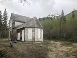
Ironton was a town in Ouray County, Colorado. The remains rest on the north side of the Red Mountain Mining District. It began in 1881 when prospectors discovered rich silver deposits. They soon established the Yankee Girl, Robinson, Guston, Colorado Boy, and Orphan Boy Mines. Giving rise to a population boom throughout Ouray County.
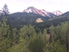
Just below the mine was a slightly sloped valley, that became known as Cooper Glen. It was established as a supply settlement in 1883. In just 21 days they built over 100 buildings. Including four restaurants, twelve saloons, and several stores. Majority of the buildings were chain-stores operated by merchants from the nearby towns of Silverton and Ouray. For the most part it served as a staging area for goods on their way to the regional mines.
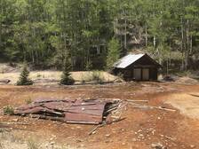
In the first few years it was ironically referred to as “Ironton”, not Cooper Glen. This name was intended as an insult because the local mine only produced low-grade Iron (not Gold or Silver). For some reason, when the post office was established, it took that name instead of Copper Glen. The townsite was officially announced in March of 1884. That very same year, Otto Mears completed a toll road between Silverton and Ouray, also known as “The Million Dollar Highway”. Bringing with it miners and travelers who often stopped in Ironton. A June 19, 1884 edition of the Colorado Daily Chieftain (newspaper) declared "Ironton is at an excellent site for a town with an ample supply of water from the Red Mountain creek for a town of 50,000 people."
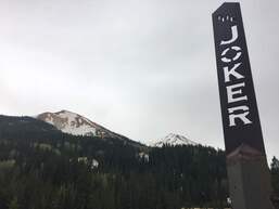
At this time, all of the supplies and precious metals were carried in and out of the valley by mule and burro pack caravans. They carried all manner of supplies including; lumber, food, equipment, hardware, and basic necessities. This was done with little more than the clothes on their backs and little protection from the elements. Despite these limitations, Ironton eventually became the primary transportation center for the Red Mountain mining district.
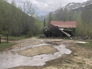
By 1889 the Silverton Railroad reached Iornton and began twice-daily service from Red Mountain Town to Silverton Colorado.This officially bridged the railway-gap from Silverton to Ouray and reduced the need for the nearby toll road (the Million Dollar highway) and eliminated the need to use mules for supplies. Furthermore the toll road closed from January and May due to snowpack and avalanches. The railway often closed at this time as well. This caused a supply and demand issue within the mines. To alleviate this issue Otto Mears built a depot, in 1889, at a cost of $2,500. The depot allowed mining operation to resume while the roads and railways were closed. The railway dramatically reduced shipping cost of the ore, but the Ironton depot is what saved the greater region from financial ruin and eventual abandonment. It’s fascinating to consider that a simple $2,500 investment saved a region that is now cumulatively worth billions.
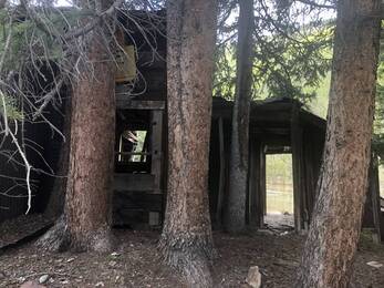
That said; by 1890 the towns population peaked at only 1,800 people. This indicates that operating the depot was the primary industry, not Ironton’s mine. However they still had a wide variety of local businesses; such as, saloons, hotels, restaurants, and mercantiles. But these businesses were primarily designed to serve the passing travelers and not the local community.
In 1893, the U.S. government demonetized silver, which forced majority of the mines in Colorado to close. By 1897, the Silverton Railroad closed its line from Ironton to the later to be abandoned, Red Mountain Town. 
The district had a resurgence in 1898. The area boomed again with the discovery of a new vein of gold. This precious metal came from the same mines that had been developed for silver, such as the American Girl, Yankee Girl, Colorado Boy, Genessee-Vanderbilt, Treasury, and a few others were built. This allowed Ironton to limp by until the early 1900s.
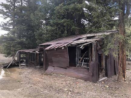
Ironton kept going by the grace of the Barstow Mine, which brought the ore down to the Barstow Mill for processing by an aerial tram. The tram was the main employer in Ironton for many years. Despite the renewed activity, the population of Ironton fell to 48 by 1910 and continued to drop. The tram produced $750,000 worth of gold before it closed in 1917.
Three years later Ironton’s post office closed and in 1921 the railroad ceased all operations to Ironton. The postmaster left a heartfelt notice on the doors saying: "The post office at Ironton has been discontinued entirely, and people must now get their mail at Guston, two miles away. Two years ago Ironton was one of the most promising camps in the mountains, a system of waterworks was put in, business and dwelling houses went up on every hand, a new church was erected, the mines were all running wide open and times were good..." Shortly after the closure of the post office, the town suffered several fires. 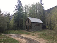
In 1938, two residents; Harry and Milton (Milt) Larson, convinced investors from Ouray to build a ski lodge for the new sport of downhill skiing, but it was never opened to the public. In 1950 it was sold to the St. Germain Foundation for a religious resort. However, it burnt to the ground shortly after it was purchased. A stone garage on the east side of Highway 550 is all that remains of the lodge.
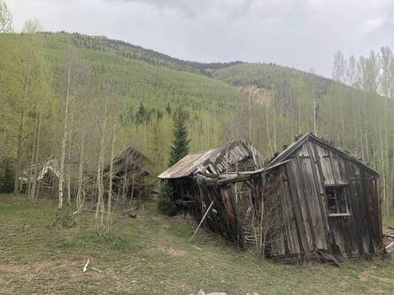
The last remaining residents of the town was the Larson family. Harry, Charles, and Milton Larson. Harry and Charles died in the 1940s but Milton continued to live alone in the abandoned town until his death in the 1960s. Milton was the self-proclaimed “Mayor” of Ironton and went by “Milt”, He was featured on an episode of “I’ve Got A Secret” on December 18, 1961. His secret for the show was, he was the last inhabitant of his town. Just a few years later he passed away and the town officially became a ghost town in the mid-60’s.
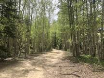
Today many of the structures collapsed under the weight of a century of snow and depending on the time of year streams of water cut through the townsite. The land is owned by the United States Department of Agriculture (U.S.D.A) and is a public use land. The public is welcome to stroll around the town site and crystal lake. But the only inhabitants you’ll find are water birds, snowshoe hares, deer, and occasionally moose or elk.
Photos from Our DayEVP Audio? What do you think?:“I’ve Got A Secret” from December 18, 1961 with Milton (Milt) Larson: |
AuthorThank you for visiting! This is a collection of media from the lost and abandoned corners of the world. Please have a look around, I hope you enjoy. Archives
April 2022
Categories
All
|
Libraries |
Support |
|

