Few places on earth have the same sense of adventure and discovery as the Rocky Mountains. With the exception of the Alps, Andes, Himalayas, and of course Antarctica. In this article, I would like to momentarily divert my attention from the Rocky Mountains to the vast frozen continent of Antarctica.
People have been desperate to understand and explore Antarctica since its tentative discovery by Captain Cook in the 1770s. Eventually, his sighting was confirmed by Fabian Gottlieb von Bellingshausen in January of 1820, when he saw the Antarctic ice shelf. By 1840 the Wilks expedition established that Antarctica was indeed a continent. Nations fell upon themselves to begin to understand, explore, and lay claim to this harsh and frozen wasteland. 
Early explorers used the methods of Native Americans to explore the Antarctic Ice shelf. Specifically, they borrow techniques from the Inuit People of Alaska; such as sled dogs and thermal-insulated clothing. However, food was scarce and these methods would not sustain the explorers very long. In order to explore deep into Antarctica innovation and invention were required.
Each successive expedition and encampment brought with them experimental equipment and techniques. All designed to better explore and conquer the unforgiving and otherworldly environment of Antarctica. Innovation would not prove easy; specifically, early vehicles and motorized equipment had a very hard time in these conditions. 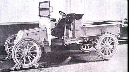
Automobiles were still in their infancy during early explorations and to this day equipment must be specially designed to withstand and operate in constant sub-zero temperatures. Each attempt to introduce vehicles to the difficult landscape and temperatures suffered faults, fails, and numerous setbacks.
British explorer Ernest Shackleton in the Nimrod expedition managed to bring the first automobile to the continent in 1909. The expedition boasted a specially designed vehicle that was donated by the defunct British automaker, William Beardmore and Company. The vehicle replaced the front tires with skis and the rear tires with large cogs. It was ultimately unsuccessful in navigating the deep snow and ice. For that matter, it could not be started at sub-zero temperatures or run for an extended period of time in the cold. Like most things in Antarctica it was repurposed and was reused as a wagon. For the remainder of this expedition, they relied on traditional sleds. 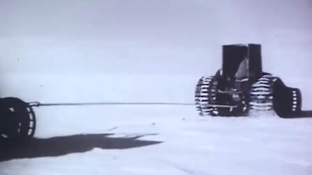
One year later; in 1910, a British Naval officer named Robert Falcon Scott saw potential in Ernest Shackleton’s idea and further innovated upon this concept during the ill-fated Terra Nova expedition. He and his engineer Reginald Skelton pioneered and advanced the concept of motor-driven sleds during their race to the south pole. But they later abandoned the idea for a caterpillar track to make it across snowy surfaces. This innovation edged us closer to something resembling the workings of a modern snowmobile.
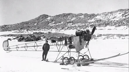
By 1911 Australian explorer Douglas Mawson set his sights on Antarctica. During his visit to the continent, he intended to bring the first airplane. Unfortunately, the plane crashed during an airshow demonstration before Mawson ever left for the expedition. Making the best of a bad situation and ever-the-showman, Mawson had the plane hastily reconstructed into what he called an experimental “air-tractor”. This was basically a tractor on skis, made out of the old Vickers airplane. This was also unsuccessful. The engine was removed and sent back to Vickers, in England. The rest of the plane was abandoned and claimed by the arctic snowdrifts. Similar to the motorcars, sleds, and vehicles that came before it. But these failures are not uncommon and it is only through failure that science can learn what does or does not work. As they say, “the road to success is paved in failure.” or “Fail fast and learn slowly.”
Flash forward 20-years to the 1930s Antarctica was to be home to one of the most incredible and ambitious vehicles ever built. The Arctic Snow Cruiser was impressive not just in its incredible size and innovative features but was also notable as an automotive masterpiece.
But before the Arctic Snow Cruiser could make its way to Antarctica the groundwork was laid by Rear Admiral Richard Evelyn Byrd Jr. from the United States Navy. Byrd is most well known for his successful flights over both the North and South Poles. Although his claim to the North Pole flight was later disputed by the Smithsonian Institute. None-the-less he was an accomplished arctic explorer who was a part of the crew who completed the first transatlantic flight in 1919. Eventually, Richard Byrd was the recipient of the Medal of Honor, which is the highest honor of valor given by the United States. 
Through the 1920s Byrd had been organizing American expeditions into Antarctica. He had established two bases on the continent; “Little America” (in 1929) and “Little America II” (in 1934).
By the end of the 1930s war was threatening to engulf the world as World War II was ramping up. Germany as well as the Japanese empire were increasing their activities and territorial ambitions around the continent of Antarctica. Because of this president, Roosevelt sought to make the US presence in Antarctica permanently established. 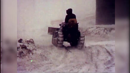
Roosevelt’s increased interest in the continent drastically improved Richard Byrd's third expedition to the antarctic. It grew out of it’s small and privately funded roots into a well-funded mission. One that looked to maintain United States bases on both sides of Antarctica. It was organized jointly by the US Department of State, The US Navy, The Department of the Interior, And the US Department of War. The base was named “Little America III” and demonstrated the United State’s interest and dedication to the arctic. A spirit that continues to this day.
This was the largest expedition the world had seen so far and nations waited with anticipation to discover the final scale of this grand expedition. However, few could guess what innovation was about to roll onto the stage. This is because Byrd and his team drew from the past experiences and failures of the equipment used and sought to design a vehicle that could incorporate the best elements of its predecessors. He had considerable success with caterpillar tracked vehicles in his previous expeditions. In fact, he credited their use directly for saving his life when he had been stranded alone in a remote outpost, during his second expedition. 
Byrds deputy, Dr. Thomas Poulter has spent the years since researching ways to adapt the motorized tractors they used to be better suited for sustained use at sub-zero temperatures. Working with the Armor Institute of Technology; in Chicago, now the Illinois Institute of Technology, Poulter designed what he called “The Snow Cruiser”. His design was a 55 feet (16.7 m) long, 25 feet (7.6 m) wide, 37-ton giant. It was designed to have a range of over 8,000 miles (12,874 km) and could sustain a crew for up to a year on the ice without resupplying. The monstrous machine was powered by two specially designed diesel-electric engines and was designed for a maximum speed of 55 miles per hour.
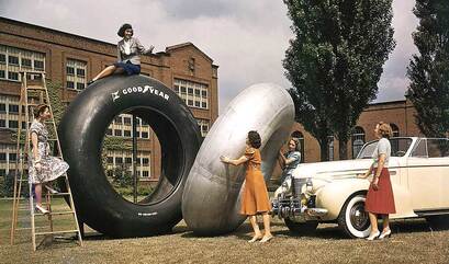
The Snow Cruiser was crammed with clever innovations; such as its four 10-foot tall balloon-like Goodyear tires. The tires and wheel assembly could be moved individually and lifted clear of crevices and other obstructions. Additionally, they could completely retract them into the chassis of the cruiser. Add to that, the tires had an innovative system that was designed to keep the rubber of the tires warm, by reusing the heat and exhaust from the engine bay.
Inside the Snow Cruiser featured all of the facilities a crew of four could need for exploring and living in the Antarctic landscape. It was complete with a control room, a machine shop, a galley, a dark room, extra tanks for fuel, food storage, crew quarters, and it even had space for two gigantic spare tires. The range of gadgets and capability were nearly endless. 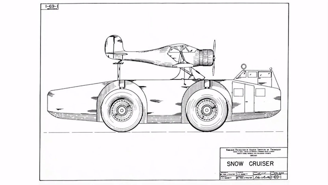
The top of the Snow Cruiser sported a cradle for an aircraft. The plane boasted a range of about 300 miles (482 km) and acted as a scout for the cruiser. The aircraft could be loaded and unloaded through the sloped back of the cruiser.
This was without a doubt the most ambitious vehicle of its time. But before it could be built it was up to Thomas Poulter to justify how this vehicle would revolutionize arctic exploration. Eventually, the US gave the Snow Cruiser project the green light and handed over $150,000 a value of $2.3-Million at that time. 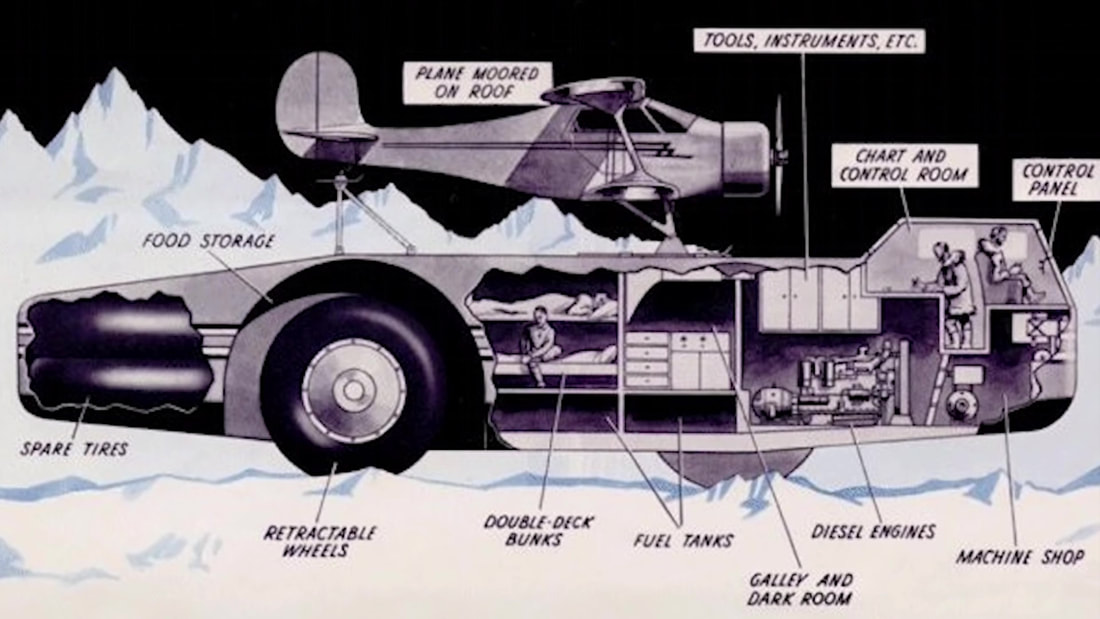
The Snow Cruiser was seen by the US congress as the crown jewel of an arsenal of new tools they looked to deploy in what was now the United States' fourth expedition to Antarctica. Especially because other countries' interests and competing claims to the region began to pick-up. While the cruiser was being built Germany had deployed a large catapult ship to the region and begun to operate survey planes around Antarctica. “Claiming” large tracks of land in the name of Nazi-Germany.
In an effort to further impress upon Congress and justify the large expedition budget Poulter began to boast about how the craft was designed to cover 500,000 square miles during an Antarctic summer. A claim that was a bit sketchy, but plausible nonetheless. With the international competition now worrying lawmakers, the Antarctic Snow Cruisers construction was expedited. 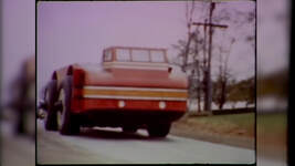
It created a national sensation as it raced off the factory-floor and across 1,000s of miles or roadways. Making its way from Chicago Illinois to Boston Massachusetts. At the time the Cruiser was wider than most of the nation's roads. To navigate around this, they executed a carefully orchestrated plan which involved closing highways and clearing traffic from the roadways ahead of the Snow Cruiser. It was a parade-like atmosphere, a sensation that was driven home by the motorcade of police that both preceded and followed the massive automobile. At one point the cruiser attempted to navigate over a creek and did get stuck for a time. While this was not a very encouraging moment, the engineers used this as an opportunity to test the independent suspension in a warmer climate.
None-the-less it made it back onto the roadway and to the Boston docks on time, where it was loaded onto the supply ship, “The North Star”. Along with Food, spare tires, several tanks, prefabricated huts, and everything they would need to live for over a year in Antarctica. In order to fit the vehicle, the entire rear-wheel section was removed and stored elsewhere. Once this was completed it was secured to the deck of the North Star. The captain had concerns about the weight being distributed properly, but after Byrd's insistence, they permitted the cargo aboard. With much fanfare the North Star and Arctic Snow Cruiser inches into the Pacific Ocean. After a few nervous moments, the captain gave his approval and set sail in November of 1939. 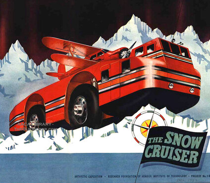
As it made its way, the New York Times surmised that: “The Snow Cruiser has connected West Base with East Base; or has rolled along that coast which no man has surely seen… or, perhaps, made itself a laboratory-based, for a period of months, at the Pole itself”. Only a few of their hopeful claims would come to pass. While it may have been a bit presumptuous of the New York Times, it goes to show just how enthusiastic Americans were about the Snow Cruiser.
The expedition reached the site of little America III in January of 1940. As the Arctic Snow Cruiser made its way off the North Star and on to a simple wooden ramp. The ramp began to give away. Leading to a tense moment when Byrd was nearly thrown from the roof of the cruiser. Fortunately, Byrd was able to run to a handhold and secure himself. Meanwhile, Poulter, who was at the wheel hit the accelerator, leaping the cruiser forward and on to the relative safety of the ice. 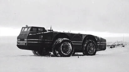
Once on the ice, they found that the vehicle was much slower than anticipated. To correct this issue, they outfitted the Snow cruiser with two spare tires for additional traction. But this design change gave way to a new problem, it was now very bouncy. In fact, it earned itself the nickname, “bouncing Betty “. Additionally, the vehicle was already at its maximum design weight. With the added weight the innovative diesel-electric drivetrain was now underpowered. Interestingly, they found that in this configuration the cruiser was fastest in reverse. So, they simply started driving it backward. However, the prospects for long-range travel didn't look good and the crew was forced to abandon these efforts.
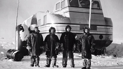
Making the best out of the situation, they used the airplane to survey large sections of the ice shelf that Little America III rested on and was able to scout into the continent.
While it’s primary purpose was not successful, it did find success as a stationary laboratory and served as the most luxurious and modern crew quarters on the continent. The innovative heating system and insulation material proved to be very effective and was integrated into future projects. However; the great Arctic Snow Cruiser was forever assigned as a stationary part of Little America III. This is how it remained until the western base was decommissioned in 1941. The entire base was evacuated later that year as the concentration of troops and funding moved to defend the world from the increasing German, Japanese, and Italian aggression. At that time the Arctic Snow Cruiser was buried with snow and abandoned. 
After World War II, In 1946, during an American expedition called “operation high-jump,” the team located the abandoned base and the giant snow cruiser sitting exactly as it had been left. The team of explorers said the vehicle was in remarkably good condition. Saying “only air in the tires and a basic servicing would have had it up and running again”. However; nothing further was done and the Arctic Snow Cruiser was once again closed up and left to the elements.
In 1958 the cruiser made its final appearance on the world stage. This time it was an international expedition that completely uncovered the snow cruiser from its tomb of ice using a bulldozer. It was hidden under several feet of snow, but a long bamboo pole left by the previous expedition still marked the location of the Snow Cruiser. Inside the cruiser was again reported to be exactly how it was leftover two decades ago. Complete with newspapers, magazines, and cigarettes still placed as if waiting to be picked back up. This group of explorers was likely unaware at the time, but they were the last people to see the incredible Arctic Snow Cruiser. 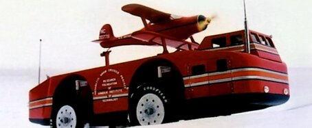
Or were they? Could it be possible that the snow cruiser is still sitting under the snow and ice of Antarctica? Somewhat recently a team located pieces of Douglas Mawson’s “air-tractor”. They were discovered under 9 feet of ice (3 m). Relics from old expeditions are found regularly to this day. Many of these items are preserved by the sub-zero temperatures and ice encasement. Some feel that the Soviets may have recovered the Snow Cruiser after it was unearthed in 1958. While this is very plausible, it is unverifiable and remains just a theory. So to answer my question, “Could it be possible that the snow cruiser is still sitting under the snow”? This is likely not the case.
This is because in February of 1963 a US Navy icebreaker ship spotted an unusual streak of brown amongst the blues and whites of passing icebergs. As they edged closer they were amazed to find what appeared to be the remains of Little America III protruding from the iceberg. The ship launched its helicopter to take aerial photos. It even landed on the iceberg in an attempt to access the base. Ultimately they were unable to find a way in, however; they could clearly make out the remains of tents, fabric, and prefabricated huts. Huts that were strikingly similar to huts that Byrd used during his expeditions. The icebreaker was able to verify that cans of food and equipment were still neatly packed on the shelves; much like the team who visited Little America III in 1958 described. Five telephone poles and antenna fitting still stood above the snow. Notably, two bamboo marker poles were still in place on the surface. 
It is a safe assumption that the ruins found by the Navy were that of Little America III. With that assumption taken into account, it means that the majority, if not all of the base has broken off the Antarctic ice shelf and has drifted away into the ocean. We do not know what part of the base that iceberg held, but it is entirely possible that one of those bamboo markers stood over the buried Arctic Snow Cruiser. It has likely drifted out to sea and eventually sunk to the sea bed. Though, a part of me doesn’t accept that this was its fate. I still hold hope that one day she will emerge jutting out of an old iceberg or maybe parched on the side of the Ross ice shelf. Perhaps it will be dredged up from the seabed by a commercial fishing operation. One thing is certain though, despite its failure to connect the East and West bases it succeeded at igniting the American spirit, imagination, and most of all innovation.
0 Comments
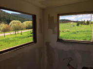
In this month's article, I would like to visit Woodland Park, Colorado. This town is so steeped in forgotten history that I will likely revisit it a few times. That said; today's tale is about a piece of property that barely missed Wal-Mart's wrecking ball and housed some of the world's earliest skiing enthusiasts.
I am focusing on land that was sold; in 2005, to Roger Thompson of the Wal-Mart real estate corporation. His intention was to develop a low-end department store combined with a grocery store. This news sparked community outrage over fears the store would eclipse main street businesses, damage historical property, and destroy the city's small-town quality of life. That April, town hall meetings were a roar with accusations, conflicts of interests, and preservation concerns
They pointed to the fact that city voters had already voted; in 1988, to not allow the town council to build city-funded infrastructure. This infrastructure was designed to entice Wal-Mart into opening a store in Woodland Park. The difference between 1988 and 2005 is that Teller County's population nearly doubled in those 17 years. With so much growth Wal-Mart no longer needed incentives to be interested in opening up shop.
Arguably Wal-Mart did not wreak all of the havoc that people feared, but the list of businesses that closed, opened, and closed again since the Wal-Mart opened is too large to keep up with. It’s a safe bet to say that the small retail-business market in Woodland Park became more volatile, but as a whole, the town seems to be better off with Wal-Mart and its tax revenue.
The town hall discussions concerning Wal-Mart was where we learned of the land’s historic significance. In response to these (and other) concerns Wal-Mart assured the people of Woodland Park that they would; preserve historic buildings, set aside 37% of the land for open space, pave the Crystola trail, and create a bronze sculpture of a local hero. As soon as the development was approved by the city council the land was transferred to “private developers” and no one heard from Roger Thompson again. These private developers only followed through with two of Rodgers’ promises; they preserved the historic buildings on the land and paved less than a mile of the Crystola trail.
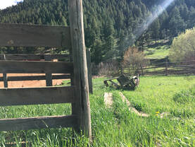
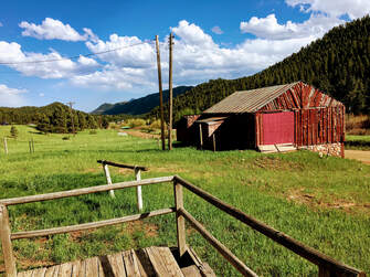
The buildings that were spared served many uses during its time. The most obvious is that it was used as a cattle ranch in the 1800s. What is not so obvious is it was once the hub of Southern-Colorado Skiing and was the home to one of the first “ski clubs” west of the Mississippi River, The Silver Spruce Ski Club. This area was one of three ski areas developed by Don Lawrie and the buildings that remain were once used as a warming house for Don’s crew. Don was a pioneer of the sport of skiing and eventually became the president of the Silver Spruce Ski Club
Don developed ski areas with the help of volunteers and he funded this with the little donations they could put together. This was demanding physical labor that was done during the heat of summer.
Lawrie was quoted in the book “Lost Ski Areas of Colorado” saying; “Back then, the ski club built all their areas with donations and with volunteer labor. We never had any money, and we had to improvise and make do. We worked hard, we skied hard and we had a wonderful time.” 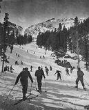
At this time skiing was considered somewhat barbaric and was not widely accepted in the United States. None-the-less Don encouraged people to try the sport and coached people to enter tournaments around Colorado. In addition to being a mentor to new skiers, he also participated as a competitor in cross-country and jumping events. Some of these events were said to have drawn up to 800 people. The competitions evolved into a great fundraising opportunity for many of the local ski clubs.
In 1929 Don implemented a plan to reduce the club membership fees in order to make skiing available to more people. Also at that time, he merged his club with the US Western Amature Ski Association. This incorporation literally brought busloads of people who were interested in skiing to the Edlow course in Woodland Park.
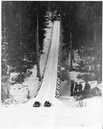
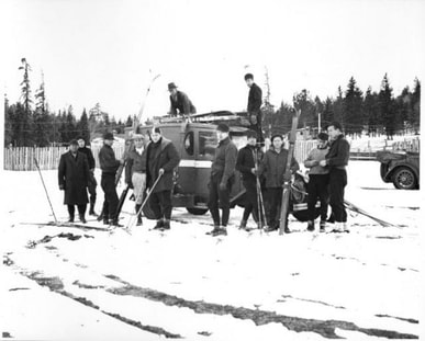
By 1936 Don’s incorporation of local ski clubs had grown out of its cross-country skiing roots and evolved into a club that was more focused on downhill and slalom skiing. The new focus of the club and the larger group brought with it a new name, “The Pikes Peak Ski Club''. That same year he adapted an old Whippet automobile engine into a mechanical tow rope, to help people up the hills. This made it so people could get up the hill without using busses or hiking. More interestingly this was a first of a kind tow rope that was widely mimicked in the Western United States 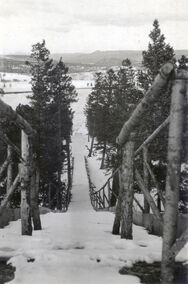
In 1948, Don Lawrie had become the Pikes Peak Highway administrator. He decided to find a new ski area that would be less windy and have more shade. With his army Weasel, he scouted a north-facing slope on Pikes Peak. This slope would later become the “Elk Park Winter Sports Area”, but it was better known as the “Pikes Peak Ski Area”. The ski run was originally cleared by the Highway Road crew, but only when they could take time away from their normal responsibilities. The area was completed by volunteers including Soldiers from Fort Carson and students from Colorado College. These hearty volunteers spent most summer weekends working on the ski runs. By night they would sleep under the stars with just a sleeping bag. Similar to the Woodland Park Ski run, a warming house was used however; in this instance, it was an old CCC building that was moved to the base of the new ski area.
In 1954, skiing was finally authorized at Elk Park. Don had created a fun and affordable ski destination. All people needed was skis, a $1 toll for the highway, and an additional fee for using the tow rope. People flocked from the nearby cities to enjoy an affordable afternoon skiing.
Don then went on to be influential in the formation of the non-profit “Pikes Peak Ski Corporation”. This charity was used to finance improvements to the ski areas for many years. Don served on the Board of Directors of the organization until the mid-sixties. 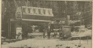
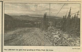
Pikes Peak became the major ski area for Colorado Springs for many years. The ski area was very small compared to runs in places like Vail Colorado or Keystone Colorado. In the early 1980’s they added a $700,000 triple chair made by Poma-USA. The Poma provided new terrain above the timberline, but snow is really hard to come by in this area. The trails were often wind-blown and packed. After the lift was put in the ski area had a terrible season, with very little turnout. Subsequently, it was not able to pay its taxes or pay Poma-USA for their newly installed lift.
Skiing on Pikes Peak or “Americas Mountain” continued until the mid-1980s. By this time the operation was becoming increasingly expensive to maintain. This is because all of the snow was man-made or shipped down from higher elevations. The city of Colorado Springs purchased the property for a brief period. But it was promptly determined to be too expensive and was sold again to Vail Resorts. The lack of snow and increased costs made it a bad investment. Vail Resorts took the opportunity to close the ski area after the 1984 season. Not only did they close down their competition, but they also closed the chapter of U.S. history about Skiing in Southern Colorado.
The heyday of Pikes Peak’s organized skiing took place near the Glen Cove area and Woodland Park. These were the sites that Don Lawrie and his friends chose before Elk Park grew into a skiing destination. Heck, it was even before Colorado was considered a ski destination. Don’s grand ideas never wavered and he was fortunate to have seen many of them become a reality. Lawrie died in 2000 and was long retired by then. But it was his dreams and ambitions that helped to create the ski scene in Colorado. He brought the skiing industry to life before it boomed in higher elevations and in well-known towns like Aspen, Vail, or Telluride.
Don’s grandson; Don Sanborn, was quoted in Colorado Springs, in regards to his Grandfather saying: “Even in his 90s, he still harbored a dream of starting a ski area, like at some hill behind the Wal-Mart in Woodland Park. We told him, ‘You need to see what ski hills and areas are really like now!'”. While Don was well aware of what modern ski resorts had become, he longed for a more simple and pure version of his sport. And to some degree, we can all understand that. To Don, this wasn’t an unreasonable idea, especially when we consider that behind this Wal-Mart was where he helped to make one of the first ski runs in Colorado. This is why I propose that the Woodland Park Wal-Mart follow through with its promise of building a bronze statue, by erecting a statue of Don Lawrence and the Silver Spring Ski Club.
Photos From The Day: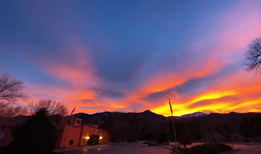
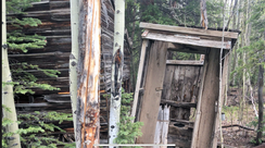
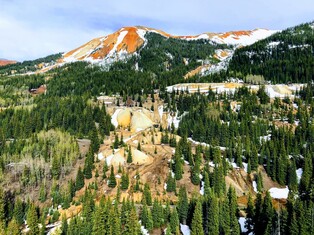
W.C. Davis and G.C McGee first purchased the Ida L. and Dauntless mining claims in 1888. By 1893 Davis sold his interest in these and other claims to W.F. Abrams of San Diego, California. McGee kept his interest until selling it to A.G. Bruner in 1910. Beginning in 1917 Bruner fell behind in tax payments and Charles L. Larson of Denver purchased the Ida L and Dauntless mines, in 1933 for only $200. Charles and family were the last few prospects in the town of Ironton Colorado. This became evident to the Larsons' when in 1920, only 3 years after purchasing their mine; the Ironton post office closed. The next year the railway stopped all service to Ironton.
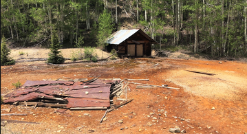
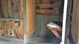
Despite the closure of the post office, lack of rail service, and dwindling population Charles and his sons continued to build on their property for 4 years. During this time they constructed a small flotation mill, a bunkhouse, blacksmith shop, and a snow shed over the mine adit (or mine opening). The concrete foundation from the mill is still visible today, behind the adit. The mine eventually had a 180-foot tunnel and a two-compartment mine shaft. In 1937 the Larsons' shipped out 25-tons of concentrated ore at a rate of $100 per ton. Which would be $2,500, but in today's currency (that would be equal to $44,811. The same year the Larson mine began to turn a profit, Charles Larson passed away. Leaving behind his two sons Milton and Harry Larson; later the duo became locally known as “The Larson Brothers”.
Despite their recent financial success, the Larson Brothers were in debt. Which limited further development on the property. They struggled to get their mine off the ground for three years. In 1940 a man named Kenneth Gerard offered to partner with the Larson Brothers and bought out W.F. Abrams. By 1951 Gerard started a diamond-drilling program. He wanted to use the flotation mill once more; however, this never came to be. Very few leases worked the mine off- and-on up until the 1960s.
In the late 1950s, the nearby Beaver and Belfast Mines owed back taxes. Kenneth Gerard and the Larson Brothers took this opportunity to buy the mines. Milton and Harry Larson operated their original mine for an additional 9 years. People who visited the brothers said that no one left without sharing a bowl of soup with the brothers. They were said to have only mined enough minerals to have what they needed. They traded their findings in town for basic supplies and trundled back up the mountain once a month. The pair shared this humble existence until Harry died in 1959
Milton continued to live in Ironton alone. In-fact Milton (Milt) Larson was best known as Ironton’s last resident. His friends and the locals dubbed him “Ironton’s mayor”. In 1964 he was given an all-expense-paid trip to New York to appear on the television show “I’ve got a secret” where his secret was; “I am the entire population of Ironton, Colorado.” Milton may have been alone; however, he was reported to be in good spirits. He was known for his detailed stories that he entertained the occasional tourist with his tales. And he allowed children to take small pieces of galena ore from his mine, as a memento. Milton continued the remainder of his days this way, until his death in 1964.
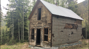
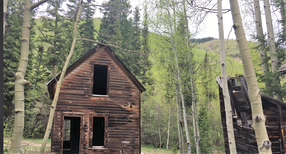
With Milton gone the property-ownership and the mining-claim went to the Gerard family. The property remained in the family for 41 years. Like the rest of Ironton, it fell into abandonment and ruin. Thankfully in 2005, Ouray County purchased the mining-claim from the Gerard family with a grant from Great Outdoors Colorado.

The property sat for another 13 years before minimum preservation began. Fortunately, the boarding house and office building were re-roofed in 2005 and the building's structure was repaired in 2018. Today The Larson Brothers Mine is an important historic site and is listed as a Ouray County Historic Landmark. A conservation easement on the property was given to the Trust for Land Restoration and this ensures the protection of the historic site from inappropriate development.
Charles, Milt, and Harry lived and died on this land. It was an important part of their lives that almost was lost to time. Thanks to the money generated by Great Outdoors Colorado we will be able to experience their home for years to come.
Milton Larson on "I've Got A Secret":Photos from the Day: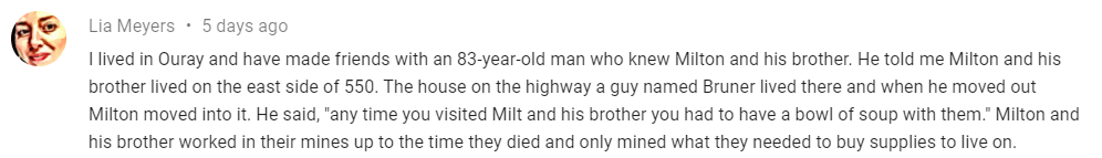

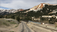
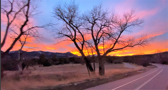
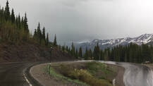
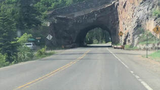
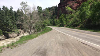
The Million Dollar Highway is a spur of U.S. Highway 50, Also known as U.S. 550. The stretch from Silverton to Ouray is frequently called the Million Dollar Highway, but it goes by other names; such as the “Scenic Byway”. If you are being dramatic it’s referred to as the “Highway to Hell”.
The road has made its way to several large publications and most dangerous lists. Popular Mechanics ranked it Number 3 of 10of the “Most Dangerous Roadways”. It is the only road in the continental US ranked by USA Today’s list of the “World's Most Dangerous Roads”. The automotive blog RoadCrazed and the DangerousRoads.org Rank the Million Dollar Highway as the most dangerous road worldwide. If you are measuring how dangerous a road is by the number of fatal accidents that happened on it the Million Dollar Highway is the winner, with no contest. This is especially astonishing when we consider war zone roads, such as; Kabul-Jalalabad Highway (Afghanistan) and Nanga Parbat Pass (Pakistan) were included in most publications, considerations, and lists. Perhaps, the “Highway to Hell” isn’t such a bad name after all?
While the highway we see today was built in the 1880s, the original trail that it was built upon is one of the roads on the “Trails of the Ancients Byway”. In other words, this passageway dates back to the start of recorded history and then some. It provides insight into the lives and migration habits of the Ancestral Puebloans and the Navajo, Ute, and Apache people. With this much history, it has a big head start on the total death count and continues to add to its total each year.
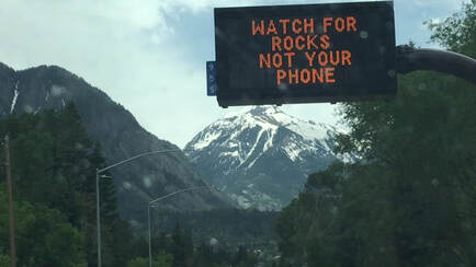
he first time you drive it, you’ll have sweaty palms. Expect sheer drops; over 2,000 feet, along the entire road and enough hairpins to make anyone seasick. This road claimed over 412 lives since 1992 and is nothing to be toyed with. The Colorado Department of Transportation (CDOT) spends an average of $2 million per year, maintaining the 24-mile (38.6 km) section of highway. In an interview with the Telluride Times newspaper a CDOT representative; Nancy Shanks gave a few simple tips for surviving the Million Dollar Highway. Shanks said, “Know the conditions, (obey) the speed limit and, if you’re a truck driver, put your chains on.” But Seriously, if you decide to visits drive with care as this is a mountain road with hairpin curves, dangerous drop-offs, and no guardrails. If you are driving south you'll be on the outside with the “no guardrails view”. Do use caution and enjoy the majestic scenery. But leave the marveling to your passengers. This road requires 100% concentration and limited distractions. So passengers, please be considerate of your drivers' nerves (and perhaps be concerned for their sanity).
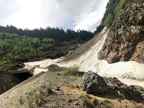
In other words, if guardrails aren’t your thing; this road is for you. The Million Dollar Highway also sports some seasonal hazards. In winter this ribbon of asphalt snakes through over 100 named avalanche paths and countless unnamed snow-runs. In the spring it is easily overcome by waterfalls and crumbling rock.
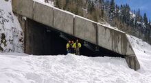
This winter blasted Colorado with its third-largest snowpack to date (since the National Resource Conservation Service started recording data in 1987). The highway had 500 torrents of snow down its slopes that killed three people, fully buried two, and nearly overtook a snowplow. According to data from the Colorado Avalanche Information Center the highway only saw 54 slides in 2018 and 140 in 2017. Meaning we saw a 72% increase in avalanches in the last year. Due to the increased amount of snow, The Million Dollar Highway can expect an increase in falling rock and waterfalls until fall.
The origin of the name “Million Dollar Highway” is very disputed. There are several legends and myths associated with its name. One of the more popular myths believes that the fill dirt used to widen the original trail had over $1 million of gold ore within it. This has been proven possible; however, it would be more like $100 million of ore under this road.
Nancy Shanks weighed in on the topic of the name and pointed to the story of Otto Mears as the most likely origin of the name. Otto was an Estonian immigrant who had become locally famous for building the Galloping railroads and Rio Grande Southern railroads. Otto began dynamiting for a basic toll road above Ouray. At the time it was said that Mears spent $1,000 per foot to construct this road. When it’s all put together this equates to a road the cost a million dollars a mile to build. Shortly after, word of Otto's expensive engineering marvel spread and the small tollway became nationally known as the “Million Dollar Highway”.
While the road has been updated over the years it still holds its old world charm and real world danger. It is an honest rollercoaster of a ride and will weigh on your nerves. People with vertigo, seasickness, or prone to panic attacks should not attempt to drive the Million Dollar Highway. It is a real treat to see, given that you have the right weather conditions, you have an experienced driver, and nerves of steel.
Raw Footage of Rain on the Million Dollar Highway:Photos From the Day:This video is also featured on Digg.com, "Here's Why US Highway 550 Is The Most Dangerous Road In America"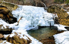
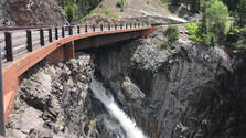
Lower Columbine Trail is a 2.2 mile lightly trafficked out and back trail located near Broadmoor, Colorado that features waterfalls and trails that suit all skill levels. The trail offers a stroll along a peaceful stream. It’s best used from April until September; however, I visited to find some of the less obvious structures that become more visible in winter.
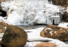
The land where the video was shot was once General William Jackson Palmers. He donated the land in order to establish a local park system in 1870. This particular portion of the park is called “North Cheyenne Cañon”.
The home featured early in the video was moved brick-by-brick In the late 1990s. However, in the early 1900s, two cottages were built at the entrance of the park to house the caretaker’s residence and storage for the park’s maintenance equipment. These two buildings burned down in the 1960s. I gave it an honest effort to find the foundations of these structures, but could not. I did, however, stumble on some very interesting spillway controls. 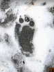
The Cañon has many tales to tell. It has a sorted history that includes a burnt hotel and an odd little structure called “the Cub”. Author and Native American advocate; Helen Hunt Jackson had a big role in the formation of the park. Please stay tuned for the next four installments to hear it all!
Photos from the Day:Music From the Video:
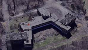
In the late 19th and early 20th century, tuberculosis hospitals became common in the United States. Over 1.3 Million hospitals were constructed during this period. In the early 1900s, Colorado’s sunny days and dry evenings attracted many people (commonly called "lungers") suffering from tuberculosis. Wealthier people chose to recuperate in exclusive tuberculosis resorts, in Colorado Springs. While others used their savings to make the journey to Arizona or New Mexico. Some formed tuberculosis camps in the desert. They were formed by pitching tents and building simple cabins. During the tuberculosis (TB) epidemic, cities in Colorado advertised the state as the premier place for treatment of TB. Many tuberculosis hospitals in the state were modeled after European away-from-city resorts of the time, boasting courtyards and individual rooms. Each tuberculosis hospitals was equipped to take care of about 120 people
The first public tuberculosis hospitals in the was in the Pacific Northwest opened; in Milwaukie Heights, Oregon in 1905. Followed soon after by the first state-owned TB hospital in Salem, Oregon, in 1910. Oregon was the first state on the West Coast to set forth legislation stating that the state was to supply suitable housing for people with TB who are not able to receive suitable care at home. The West Coast became the most popular spot for TB Hospitals
The greatest area for tuberculosis hospitals was in Colorado Springs, CO with over 13 resort-style facilities in the city. By 1920, Colorado Springs had 9,000 people who had come for treatment of tuberculosis. Too many people came to the West, in-fact not enough housing was available for them all. By 1910, more tent cities began to pop up in Arizona and New Mexico; many described as a place of squalor and shunned by most citizens. Most of the TB infected slept in the open desert with no housing. The area adjacent to what was then central Phoenix, called Sunnyslope, was home to another large tuberculosis encampment, with its residents only living in tents pitched along the hillside of the mountains north of Phoenix. Several tuberculosis hospitals opened in southern California in the early party of the 20th century due to the dry, warm climate.

The first tuberculosis hospital for blacks was ironically in the segregated South. It was called the “Piedmont Sanatorium” in Burkeville, Virginia. Although locally it was referred to it as the “pigeon sanatorium” the most famous non-segregated tuberculosis hospitals is the Waverly Hills Sanatorium, a Louisville, Kentucky, tuberculosis sanatorium, from 1911. It is a mecca for curiosity seekers who believe it is haunted. Because of its dry climate, Colorado Springs was home to the most sanatoria and tuberculosis hospitals. A. G. Holley Hospital in Lantana, Florida, was the last remaining freestanding tuberculosis sanatorium in the United States, fortunately, it closed on July 2, 2012.
The closures were and are welcomed by the American people. It closes a horrific chapter in our history. The decline of tuberculosis started in 1943, when Albert Schatz, a graduate student at Rutgers University, discovered an antibiotic and the cure for TB, tuberculosis hospitals began to close rapidly. As in the case of the Paimio Sanatorium, many were transformed into general hospitals, jails, or schools. However, over 1 million tuberculosis hospitals were simply abandoned. Half of these were demolished by 1949. By the 1950s, tuberculosis was not a large public health threat; it was controlled by medicine rather than extended rest. Most tuberculosis hospitals were demolished years before.
Some, however, have been adapted for new medical uses. The Tambaram Sanatorium in south Indiana is now a hospital for AIDS patients. The state hospital in tuberculosis hospitals, Mississippi, is now a regional center for programs for treatment and occupational therapy associated with intellectual disability. Photo's from the trip:Music from the video: |
AuthorThank you for visiting! This is a collection of media from the lost and abandoned corners of the world. Please have a look around, I hope you enjoy. Archives
April 2022

Categories
All
|
Libraries |
Support |
|